The RAUMKARTE contains a collection of official geographical data layers that can be selected through a filter area to help organisers find and identify suitable event locations in public spaces.
The spatial data layers and the QUICKCHECKER tool allow users to assess the potential impact of an event on the surrounding area. This should optimise the selection process of event locations.
Location Search
Finding a location is greatly simplified by the RAUMSONDE. There are three ways to find a location:
1. Selection on the map
You can simply select a location via the Space map and the address will be displayed automatically.
2. Enter coordinates
If you already have the coordinates for your event, you can enter them in the corresponding field.
3. Enter address
If you already know your location, entering the address will automatically display it on the map. You can also search for places of interest like a park, square or a location such as a museum or similar.
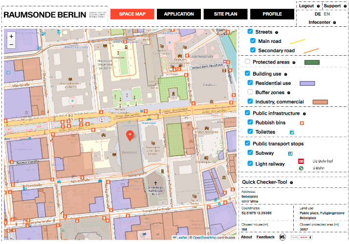
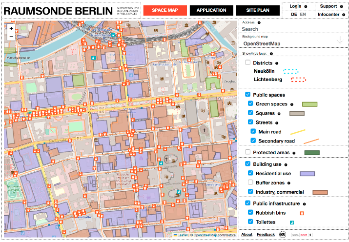
Space Map
The SPACE MAP is the main page of the RAUMSONDE where you can find suitable public spaces for your cultural events. Here you can do a free search and select a location directly on the map. The layers are a useful help here.
Background map
Here you can switch between OpenStreetMap (classic map) and a satellite image to get a better understanding of the surroundings.
Show/hide data layer
The data layers, which you can show or hide by clicking on them, help you to better assess the impact of your event on the surrounding area or the accessibility of the location. They give you the opportunity to avoid conflicts in the run-up to registration. Different characteristics relevant to the selection of a location are shown here, such as land allocation, building use, infrastructure and much more.
Quickchecker Tool
The QUICKCHECKER tool calculates and displays the most important information (such as address, type of area, distance to the night-time protected area or residential development, etc.) for a selected area. All you have to do is click on a location on the map. This should help you to make an informed decision.